Showing posts with label Running. Show all posts

Thursday, February 4, 2021

Kinugasa Yama Park

Kinugasa Shrine, right outside the park entrance

I think this park becomes quite popular during the sakura, but the remainder of the year that I’ve seen so far it’s a beautiful secluded place to take the family and I love running through here. There’s a great park for kids (to include a really fun loop-de-loop climbing area) and two observation towers.

Maps & Trails

As with most parks there are decent rough maps of the park posted all over the place.

The standard park map

This park map is very accurate (as far as showing all the trails and how they connect to each outerh) but it doesn’t show where the trails come out or help with parking so I made my own Google Map. The blue trails are paved and the brownish-orange trails are unpaved. I’ve also included some trails for the Kinugasa Ruins on the other side of 27.

The main path from the entrance to the observation tower and playground loop are paved although it does have some slope to it in places. The main paved path splits about 170 m from the entrance with the left path going towards the observation tower (another 300 m) and the right path going to the playground loop (another 430 m). The playground loop itself is 410 m.

Main paved path through the park

The rest of the trails connect these two split paved paths or go off to various exits.


What to do

Playground

If you just look at Google Maps, this one can get a little confusing. It shows three playgrounds. I’ve run through here a lot and as near as I can tell the other two are just open areas without playground equipment. For kids you want to do a Google Map search for the southeastern-most one: わんぱくの森 (here).

Would the real playground please stand up

This one has a fun little mesh rope bridge that goes around the main structure. It also has nice shade on one side for watching your kids. You’ll often see school trips here of folks picnicking in the shade.

The boyz heading down the stairs to the park
Other end of the playground
Our kids loved the rope tunnels & bridges

Loop-de-Loop

On your way down to the playground from the main entrance you’ll walk by this big loop-de-loop rope tunnel. We almost just walked by this structure but our kids would not let us. It has a bit of sway to it, but it seems safe enough.

Yes, it's as much fun as it looks

Observation Deck

Like any self-respecting Japanese park with a hill, Kinugasa Yama also has an observation deck (Google Map search: 衣笠山公園展望台). It has great views of Fuji, Yokosuka and Kannonzaki Point. During the spring you could probably get some great shots of Fuji through the blossoms and new leaves.

Alita with a very faint Fuji-san in the background

Sakura Viewing Area

There are two beautiful orchards where you can see beautiful blooms in the spring. We have not yet done our first sakura so I might update this later. But even if you visit other times of the year, the main one has some neat wood carvings and it’s still a great area for a picnic. You can find one of the viewing areas with Google Maps by searching: 衣笠山公園上の広場 (here).

No blossoms in December? No problem for our kids.

Parking & Access

Main entrance

The best parking option is by the shrine. In Google Maps if you enter “Kinugasa Shrine” it will get you very close (you just have to drive past it another 100 m).

Kinugasa Shrine

The parking is just past the shrine on the left as you go up the hill. The lot is open from 8:00 - 17:00. It has 14 parking spots. Outside of the sakura, it’s a pretty quiet park and I’ve rarely seen the lot full before 10:00.

There is one bathroom and vending machine here and two other bathrooms in the park. The next one is 170 m down where the main path splits by the cherry tree groves. The third bathroom is down towards the playground.

There are some other parking places that I have not investigated but that may work in a pinch of during the busier times of year. I have run by several parking spots on my map but have not tried these ones out:

There’s a spot about 200 m down from the shrine. Using my phone’s translate function I think it’s overflow parking for the elderly during the sakura.

A surer option is a 4 -5 spot paid parking about 600 m / 10 min walk up the hill. It’s ¥100 / 20 min during park hours.

Bamboo Forest Access

This is one of the less traveled sections of the park but I think it’s one of the prettiest ways in and probably the quickest way to the playground. At the end of this residential street there are three parking spots.

Parking spots for the bamboo forest entrance

From this trail you walk about 185 m through a beautiful bamboo forest.

Then you come to a T intersection with one trail that heads north into another neighborhood. This is a good access option although the parking is not as good right at the trailhead.

To the south the trail takes you to another intersection. Going east will take you to the playground / playground loop. From parking to the playgroun is only about 400 m.

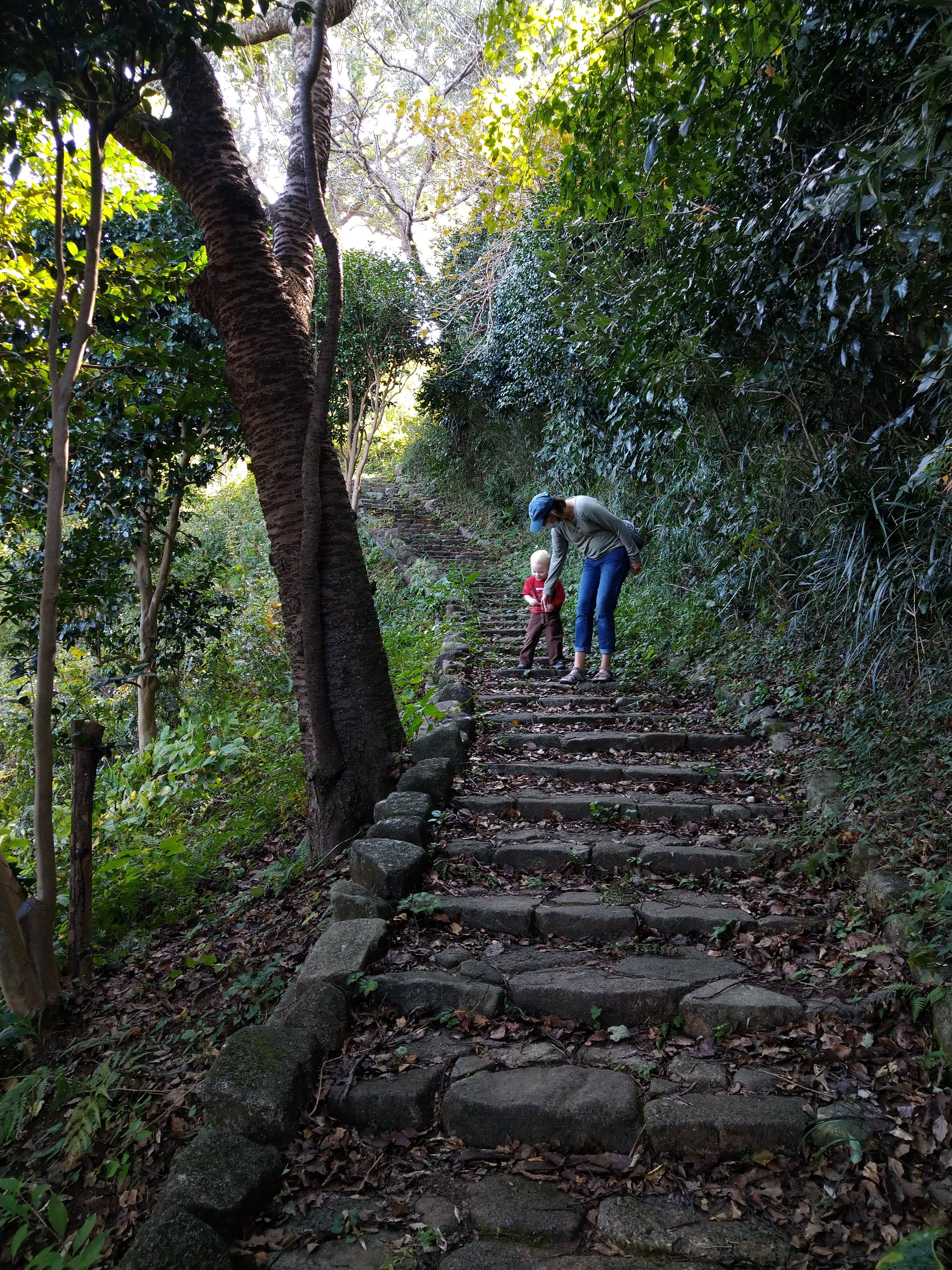
Going south will take you 300 m uphill to the observation tower. Most of the path is stone lined steps although some are the dirt and log steps that tend to wash out in places.

Ave / Ridgeline Trail

This is my favorite way to run into the park. Ridgeline trail is my own personal name - so don’t look for that translation from the signs. The parking area above is also right next to a ridgeline trial. I’d be tempted to park at the AVE Kinugasa shop but I’m going to guess that they monitor for Kinugasa Yama parking.

You’ll see a little statue and sign along the road. Turn and run up along the white fence, but keep going straight when the road bends. You’ll eventually come to a set of log stairs that are the official start of the trail.

Little shrine that marks the spot from the road
Sign for the trail. Go up and over the chains at the top

The trail is about 660 m and goes along a ridge. It goes by two picnic tables which always amuses me. In the in winter it’s a bit cold to picnic but when it’s warm enough to picnic the bugs are a little intense.

One of the picnic tables on the way up the ridgeline

The trail goes up and over a small knoll about halfway with some stairs on either side.

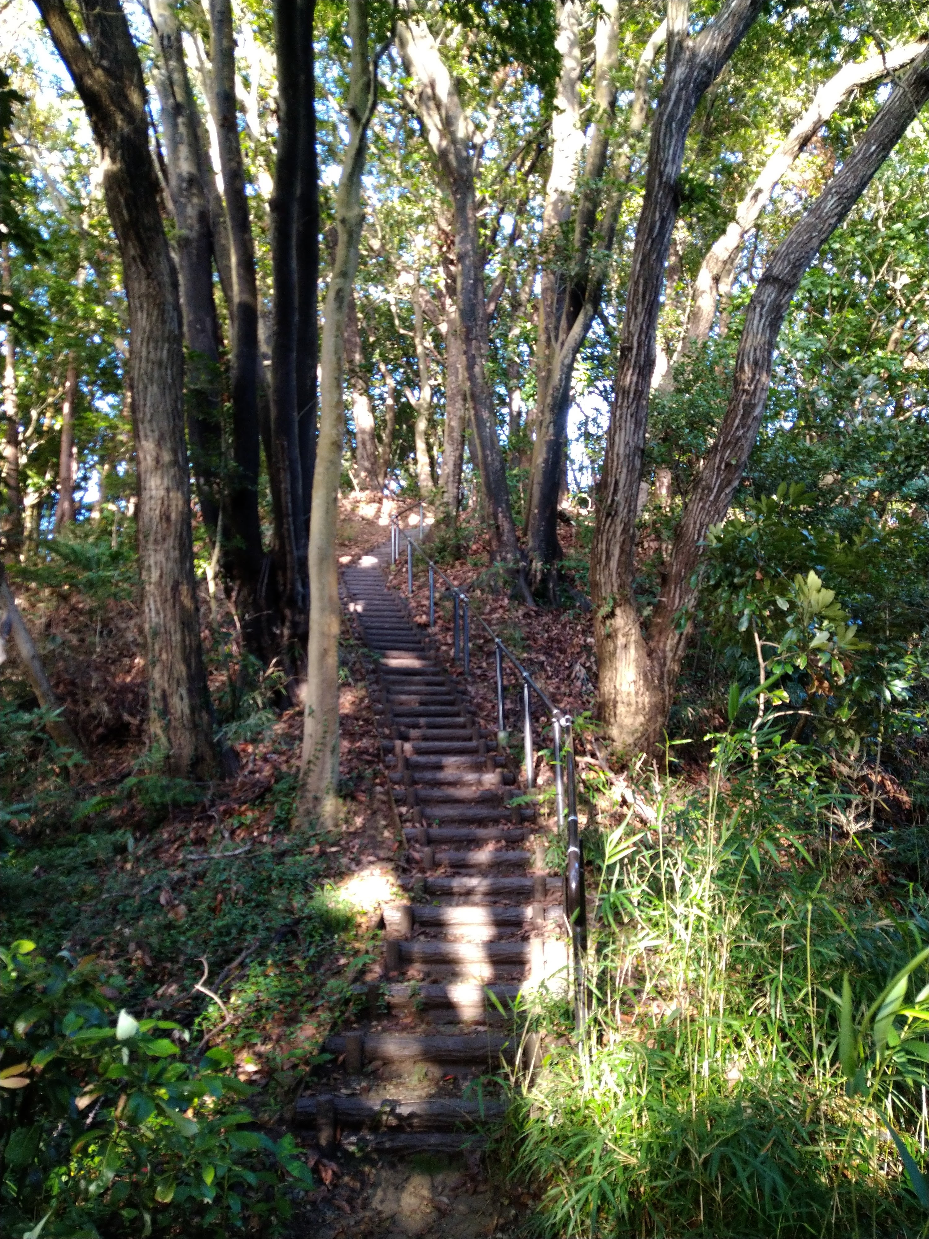
Stairway over the knoll

Just before the trail joins with another connector trail, you go along a wall with some nice views of the neighborhood.

Nice views of the neighborhood before you connect to the rest of the park

Neighborhood Access

At the northeast end of the playground loop there’s a 250 m gravel path that goes out towards the Kinugasa Hospital. This access is about a 4 min walk from some paid parking. If you just wanted to go to the playground this would be your easiest bet.

Route 27

This is not really main access so much as a connection to the Kinugasa Castle Ruins (which sounds a little more exciting that what is actually there). But if you enjoy trail running and want to connect to Mount Oogusu (大楠山) and trails beyond, this is your huckleberry. It’s steep and a lot of the dirt behind the log stairs has eroded. But I love that you can run through Kinugasa Park and connect to so many other great trails.

There is one spot just down the road toward the 16 Expressway intersection where I occasionally see cars parked, but I’m not sure about the rules and would be wary of parking there myself.

Saturday, May 4, 2019

Running and Traveling

I often have to travel for work and I love exploring an area by running when work allows. The pace of running and the ability to explore small paths is a nice middle ground between walking and driving for getting the feel of a place.

I give a lot of weight to proximity. If running in the morning during a work trip I almost always have somewhere I have to be at a hard time. If running after work I have limited energy and time left to run, eat and close up work. The more time spent traveling the less time spent running. To this end in particular, a little research ahead of time can really make running while traveling a lot more rewarding given limited time.

Bringing on the Heat

The first place I go nowadays when researching running routes for travel is Strava's heat maps. For a while I thought this was a premium feature (only available to paying members) . . .

Well, nuts. . .

Then my friend showed me how to access this cool feature for free. . . you first:
1. Got to My Routes
2. Select "Create New Route"

3. Click on the Settings wheel and 
4. turn on Global Heatmaps


Voila! You instantly have the collective feedback of where hundreds of other runners most often go. Big popular routes show up nice and bold.

Safety

The fewer road crossings the better and I hate finding myself needing to connect a loop along a busy highway with a 55 mph speedlimit and a 1-ft shoulder. If I'm going to try to connect a loop that does not show some traffic on a heat map I like to check Google Earth to help me feel that I can safely run along the side.

For example, recently I wanted to take a run from my hotel. Strava shows some nice popular routes pretty close by but a worryingly less popular stretch in between.


Google Earth reveled that indeed this was not an overy pretty stetch

The Wisdom of Crowds

The next thing I like to check when traveling is searching for running groups. Often I do not have time for group runs before or after work, but when I do I find it really rewarding to run with other folks.

Other Resources

Map My Run and similar sites

If you just Google "Running routes in (some location)" you often get a lot of good websites that will suggest some routes. For general running routes of trails and roads I like Map My Run. The advantage it has over other popular sites (such as USATF routes and Runkeeper) is that you can easily search the routes on a map. Since I'm looking for runs based on where I'm staying or going to be this is more useful than a list of popular routes.


Map My Run also has the nice feature of being able to download routes and GPS or KML files.


The main caveat I have with these website is that they don't always give you a full pictures of all of the great options that are out there. They show a small percentage of a few uncurated routes that can give you some ideas. When I look at my local stomping grounds a lot of really good loops are just not there.

Trail Running

For trail running my favorite source of inspiration is REI's Trail Run Project. The nearby trails show up nice (and it seems to focus more on the dirt and single track trails) along with good filtering options.

Planning a Route

After getting inspiration from Strava and other sites I may still sometimes cobble together a route that fits my particular hotel or parking location. While Strava has a Route Planner I have found that it's adherence to roads and trails sometimes just does not match the physical reality of what I know I can do on the ground. In these cases I like to turn to Plot a Route. This site has the nice features of letting you turn tracking off or set it to roads or foot.


You can then save the route or (as I often like) export it as a GPX or KML file.


The Map is Not the Ground

After I first noticed the green space on Google Maps I looked up trail maps for Patapsco State Park online. The maps were great for getting the overall structure of the trail system and doing some basic route planning. But the disadvantages quickly became apparent when I started running. The maps only showed park roads and not rather convenient features like local roads and streams. The maps also did not all newer trails.

Without Will Surles showing me this trail I never would have found this cool loop
Google Maps shows many trails but I have found Strava to have the most complete trail maps (although still not perfect). Below shows a fun connecting trail that I took after discovering it on Strava that did not show up on Google Maps.

Strava

Google Maps

Saturday, June 2, 2018

Arctic running


Annual training for my Army Reserve unit was at Eielson AFB and Ft. Wainwright up near Fairbanks, AK this year. Even though my wife was born in Alaska (and even went to school at the University of Alaska at Fairbanks) I had not yet made it up and was excited for the chance to see a new place.


Unfortunately this is just a running blog post and not a fishing blog post as we went in April. It’s a slightly sad time of year where there’s not enough snow to go skiing or snowmobiling (or snow-machining as they say in Alaska) but too much snow to hike or fish (and the salmon aren’t yet running).

Eielson running


In spite of being an Army unit, we were staying on the air force base. The inn on base had a rather nice welcome packet that suggested a 1-mile, 5k and 10k routes.


This was a pretty good place to start although I found the 10k route to be closer to 5.2 than 6.2 miles. All routes were on roads with good shoulders or sidewalk and reasonable traffic.

For longer runs I found that running out past the power plant on base brought you to a nice open road that goes past the fuel farms, to the covered range where you come to a Y (64.655706°, -147.002964°). If you go right you get to the ski hill (Iceman Falls), a sheet range and a nice set of cross country trails (64.649480°, -146.979207°). These trails were a bit muddy for the time of year when I was there so I did not run any of them.


The base also had a nice indoor and outdoor track as well as an obstacle course / trail.

Beach Bum 5k

We were there over one weekend which happened to have the University of Fairbanks hosting a race. In traditional fashion I wanted to get there an hour early to get parking and have ample time to warm up. I need not have worried as there was about 50 people at the race.

Starting area of the race
The course made most of its 170 ft of elevation gain in the first mile. Once it leveled out on the north side of campus we got some great view of Denali before heading back through the center of campus to the start. It was a perfect low-key race to break up the annual training.


Charles and I at the finish

Hoodoo Brewery Run

The other running highlight of my time in the area was the weekly 5k fun runs from Hoodoo Brewing. The run was organized by Running ClubNorth. About 75 – 100 runners did an out-and-back course from the Brewery. Both times we went down to the Chena River but one week we went east the other week we went west.

While it was a fun run there was an advantage to getting back earlier as the beer line quickly got long.


Post Run Brews
Hopefully I get to go back and explore Alaska in the summer when there are more trails and salmon. Until next time.


States that I've raced in

Saturday, November 25, 2017

Army 10-Miler

My opportunity

I was at my annual training in June this year and I saw a flyer to try out for the Ft. Hunter-Liggett Army 10-Miler team. I called the point-of-contact who told me to show up at 6 am in a few days. Ft. Hunter-Liggett did a rolling try-out. Over the course of two months if Ivan, the MWR guy running the show, had time you could run or submit a time. At the end of July he would pick the fastest times an notify folks.


I ran the course with LT Wade Phillips. The Ft. Hunter-Liggett time trial course had a slight uphill on the way out which made for a nice negative split on the way back. I ran a 63:07 and felt pretty good about my chances.

Army 10-Milers Past

This would not be my first trip to DC to run the Army 10-Miler. In Iraq I was fortunate to have met up with some other runners in my brigade who were in contact with the major in the division who was running the Ft. Campbell tryouts. Every Sunday they would transport runners from our brigade to the other side of Camp Victory to run around Saddam’s palaces and lakes. I made the team and shortly after we got back we all drove from Ft. Campbell to DC.

Camp Stryker Running Crew. 2 BCT / 101st Airborne Division\
I had a good enough time that the next year when I went to Ft. Leonard-Wood for the Engineer Captain’s Career Course I called up the MWR and get in contact with LTC Jackie Chan (yes, that was really her name) and trained with that team. We placed third in the Active Army mixed team category.

2007 Ft. Leonard-Wood Army 10-Miler Team
Every deployed post that I was at in Iraq, Afghanistan and Kuwait put on some version of the race. It was free and always fun challenge over the usual 5k runs.

2014 Army 10-Miler in Camp Arifjan Kuwait

Transportation and Lodging

Army teams typically stay in the Crystal Gateway Marriott. It is stunningly convenient to get to the start. You could take the metro in the basement of the hotel but I got the impression that some years the Metro had not supported the race by opening early and that the years that it was open it was rather crowded. It is easier just to walk north along S Eads St. – it’s pleasant and a nice way to stretch out the legs prior to the race.

Getting to the start of a race with 25,000 doesn't get much easier
The other advantage of the Crystal Marriot or similarly located hotel, is that you are right next to the MountVernon Trail. This trails goes for miles and is free of road crossings. If you go north you are even blessed with nice views of the mall and its monuments.

Traveling into Reagan National Airport is the most convenient way to do the Army 10-Miler. There is an easy Metro that takes you one stop down to Crystal City (or into the city and other Metro lines). Dulles has public transit options but they involve a bus and transfers. There is enough to do in DC that there is no good reason to get a car.

Metro with the airport, hotel and race start. Doesn't get much more convenient

Expo

If you are active duty packet pick-up opens at 8:30. For the general public it opens at 10. While it might be tempting to sleep in, the line into the Armory explodes if you wait. At 9:30 we walked right into the building and had our packet and shirt in less than 10 minutes. When we left the line wrapped around the block and almost reached the metro stop.

Packet pick-up line around 11 am
The expo itself was nice enough and I found a good deal on some running shorts that I felt I was running low on (my wife throws away pairs long before my cutoff of being unable to tell which holes are for the legs).

Ft. Hunter-Liggett team at the Expo

 Race Day

We got to the race about an hour before the start. There were ample toilets (at least at more than a half-hour to the start). There was a nice section of the course that was closed to traffic but not part of the first mile that made for a good warm-up area.


I started near the middle of my wave. As with the New York City Marathon I should probably have muscled my way closer to the front. But the first split was still a little below my goal pace of six-minute miles (3:45 kilometers). I kept up a good shown until the halfway point when the rain, wind and temperatures began to get the best of me. I was somewhat relieved to learn later that it was not just me. After around 10 am the Army made the call to shorten the course andcall the event a fun run.

Pace at each kilometer
However, I did seem to weather the weather reasonably well. I passed a lot of folks in the second half of the race and even put in a strong split on kilometer 15. I crossed the finish in 1:01:47.


I waited around for LT Phillips (who I had run the time trial with many weeks ago). Our ringer, CPT Foster (who ran for a few of the All Army teams) had finished long before both of us. We found Ivan (aka coach) and my family who had come out. 

CPT Foster, Wade and I did a rather nice cool-down on the Mount Vernon Trail which was easily accessible from the northeast corner of the parking lot. We crossed a bridge and found ourselves on nice secluded section of the trail - a nice chance of pace from the crowded racing and warm-up.


We were fortunate to bring home the Army Reserve Mixed Team trophy (top four times with at least one male and female time)
Coach with our sweet trophy

Being a Tourist


I have been grateful each time for the opportunity to stay the afternoon after the race. There is so much to see around DC within an easy metro ride. The capital tour was a little challenging with two small kids but the mall was perfect.

Kid approved Washington DC tourism

I was grateful to the Army Reserves for the chance to run in DC again. My only regret was not getting to see more of my friends from the Kuwait Running Mafia. I’ll pick them up next time.